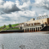
Overview
The Lehigh River in Northeastern Pennsylvania was subject to significant flooding each spring due to snow-melt and spring rain. These freshets would cause severe flood damage extending all the way to Philadelphia where the river empties into the Atlantic Ocean. Bridges and dams were often destroyed.
To help alleviate the damage due to these devastating floods, and prevent seawater from entering the water supplies in the Philadelphia area, the Francis E. Walter Dam was constructed near the headwaters of the Lehigh River and dedicated in 1961.
The dam, with ancillary projects such as the building of the levies at Weissport, has nearly eliminating Lehigh River flooding. It was constructed by the US Army Corps of Engineers which also constructed and maintains recreational facilities to provide public water use opportunities including fishing, boating, disc golf and white-water rafting. The dam is located in Luzerne County, stands at 1,509 feet above sea level and encompasses a watershed of nearly 300 square miles. The reservoir is impounded by an earthfill embankment covered with a rock shell, with a concrete spillway at elevation 1,450 feet. Total capacity at elevation 1,450 feet is 110,700 acre-feet. The impoundment also provides water during summer droughts.
What We Did
In 2009, the Philadelphia District of the Army Corps of Engineers (COE), in response to concerns regarding seepage observed at the dam, contracted with Layne GeoConstruction of Ruther Glen, Virginia to drill exploratory borings in the foundation of the rock to determine the permeability of the subsurface material and install a double-line 600 linear foot grout curtain along the center of the dam. Included in this contract was a complete upgrade of the existing automated piezometer monitoring system including the addition of several new piezometers.
We were contracted by Layne to provide all the products and services related to the upgrade of the existing system as well as integration of the new wells. A hybrid wired/wireless system was designed to re-use existing wiring where possible and incorporate additional wiring and wireless nodes for the new wells.
A Campbell Scientific CR1000 operates as the datalogger and master controller for 7 additional wireless collection platforms consisting of Campbell Scientific AVW216 Vibrating Wire Interfaces with integrated 2.4GHz radios. Four of the wireless nodes also include our MultiMux instrument multiplexer, this provides channel expansion with integrated lightning protection. The remaining 3 wireless nodes are 2-channel nodes. A total of 36 vibrating wire piezometers are automated, pool level and barometer are also automatically recorded. All the electronics are battery powered with solar panels for recharging. A multi-channel remote incorporating our MultiMux is shown at right, below is the CR1000 based datalogger.
Data Collection
Two methods of communication to the system were supported; first a wireless link to the local District office and a connection to the Corps Wide Area Network (WAN), second an analog phone modem to be used as a backup in case the COE network is unavailable.
Our MultiLogger Suite software provides an easy-to-use interface for the programming and management of the system including configuration of the remotes, selecting instrument types and converting to engineering units. MultiLogger, running on a computer in the Philadelphia District COE offices, also automatically collects data once per day from the station and imports it into the COE WinIDP data management software. Our services also included assisting with the setup of the data collection and import as well as training of COE personnel in the use of the hardware and software.


